
Thank you for supporting this site ❤️
Make a donation
Make a donation
Baptiste Lake topographic map
Click on the map to display elevation.
Thank you for supporting this site ❤️
Make a donation
Make a donation
About this map
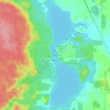
Name: Baptiste Lake topographic map, elevation, terrain.
Location: Baptiste Lake, Athabasca County, Alberta, Canada (54.72304 -113.57336 54.79016 -113.52821)
Average elevation: 609 m
Minimum elevation: 574 m
Maximum elevation: 684 m
Thank you for supporting this site ❤️
Make a donation
Make a donation
Other topographic maps
Click on a map to view its topography, its elevation and its terrain.