
高坪镇 topographic map
Interactive map
Click on the map to display elevation.
About this map
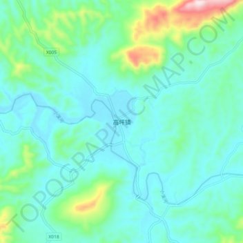
Name: 高坪镇 topographic map, elevation, terrain.
Location: 高坪镇, 浏阳市, 湖南省, 中国 (28.16312 113.75521 28.24312 113.83521)
Average elevation: 171 m
Minimum elevation: 85 m
Maximum elevation: 544 m
Other topographic maps
Click on a map to view its topography, its elevation and its terrain.