
Thank you for supporting this site ❤️
Make a donation
Make a donation
Indian Springs topographic map
Click on the map to display elevation.
Thank you for supporting this site ❤️
Make a donation
Make a donation
About this map
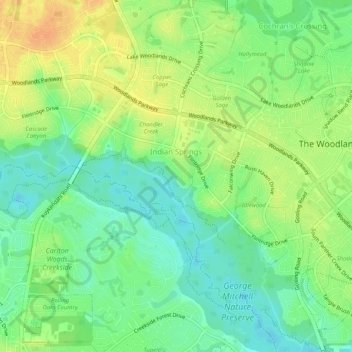
Name: Indian Springs topographic map, elevation, terrain.
Average elevation: 48 m
Minimum elevation: 32 m
Maximum elevation: 66 m
Thank you for supporting this site ❤️
Make a donation
Make a donation
Other topographic maps
Click on a map to view its topography, its elevation and its terrain.
Lazy River
United States > Texas > Montgomery County > The Woodlands > Wild Ridge
Average elevation: 44 m