
Thank you for supporting this site ❤️
Make a donation
Make a donation
Groot-Gelmen topographic map
Click on the map to display elevation.
Thank you for supporting this site ❤️
Make a donation
Make a donation
About this map
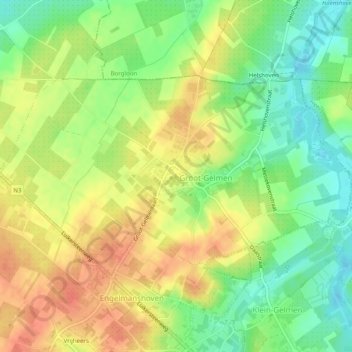
Name: Groot-Gelmen topographic map, elevation, terrain.
Location: Groot-Gelmen, Sint-Truiden, Hasselt, Limburg, Vlaanderen, België (50.77428 5.23740 50.79220 5.28686)
Average elevation: 79 m
Minimum elevation: 54 m
Maximum elevation: 103 m
Thank you for supporting this site ❤️
Make a donation
Make a donation
Other topographic maps
Click on a map to view its topography, its elevation and its terrain.
Thank you for supporting this site ❤️
Make a donation
Make a donation
Thank you for supporting this site ❤️
Make a donation
Make a donation