
Thank you for supporting this site ❤️
Make a donation
Make a donation
Buzzard Roost topographic map
Click on the map to display elevation.
Thank you for supporting this site ❤️
Make a donation
Make a donation
About this map
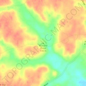
Name: Buzzard Roost topographic map, elevation, terrain.
Location: Buzzard Roost, Calloway County, Kentucky, United States (36.65889 -88.15925 36.65899 -88.15915)
Average elevation: 140 m
Minimum elevation: 107 m
Maximum elevation: 161 m
Thank you for supporting this site ❤️
Make a donation
Make a donation
Other topographic maps
Click on a map to view its topography, its elevation and its terrain.