
Thank you for supporting this site ❤️
Make a donation
Make a donation
Pittsburg topographic map
Click on the map to display elevation.
Thank you for supporting this site ❤️
Make a donation
Make a donation
About this map
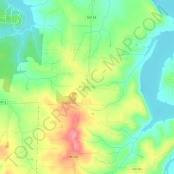
Name: Pittsburg topographic map, elevation, terrain.
Location: Pittsburg, Hickory County, Missouri, 65724, United States (37.81811 -93.31763 37.85811 -93.27763)
Average elevation: 291 m
Minimum elevation: 254 m
Maximum elevation: 344 m
Thank you for supporting this site ❤️
Make a donation
Make a donation
Other topographic maps
Click on a map to view its topography, its elevation and its terrain.