
Thank you for supporting this site ❤️
Make a donation
Make a donation
Salt Rock topographic map
Click on the map to display elevation.
Thank you for supporting this site ❤️
Make a donation
Make a donation
About this map
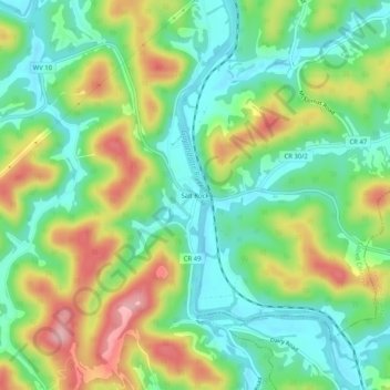
Name: Salt Rock topographic map, elevation, terrain.
Average elevation: 226 m
Minimum elevation: 164 m
Maximum elevation: 328 m
Thank you for supporting this site ❤️
Make a donation
Make a donation
Other topographic maps
Click on a map to view its topography, its elevation and its terrain.
Pea Ridge
United States > West Virginia > Cabell County > Barboursville > Tallwood Acres
Average elevation: 197 m