
Meredith topographic map
Interactive map
Click on the map to display elevation.
About this map
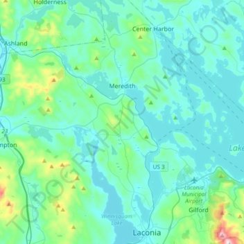
Name: Meredith topographic map, elevation, terrain.
Location: Meredith, Belknap County, New Hampshire, 03253, USA (43.55289 -71.64258 43.69869 -71.34413)
Average elevation: 215 m
Minimum elevation: 142 m
Maximum elevation: 719 m