
Paterswolde topographic map
Interactive map
Click on the map to display elevation.
About this map
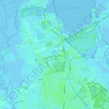
Name: Paterswolde topographic map, elevation, terrain.
Location: Paterswolde, Tynaarlo, Drente, Niederlande (53.13937 6.53392 53.16785 6.58737)
Average elevation: 2 m
Minimum elevation: -4 m
Maximum elevation: 8 m
Other topographic maps
Click on a map to view its topography, its elevation and its terrain.
Eelderwolde
Niederlande > Drente > Tynaarlo
Eelderwolde, Tynaarlo, Drente, Niederlande
Average elevation: 0 m
Zuidlaarderveen
Niederlande > Drente > Tynaarlo
Zuidlaarderveen, Tynaarlo, Drente, Niederlande
Average elevation: 2 m
Oudemolen
Niederlande > Drente > Tynaarlo
Oudemolen, Tynaarlo, Drente, Niederlande
Average elevation: 8 m