
Thank you for supporting this site ❤️
Make a donation
Make a donation
Nantyglo topographic map
Click on the map to display elevation.
Thank you for supporting this site ❤️
Make a donation
Make a donation
About this map
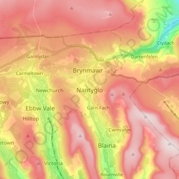
Name: Nantyglo topographic map, elevation, terrain.
Location: Nantyglo, Blaenau Gwent, Wales, NP23 4PU, United Kingdom (51.74945 -3.21273 51.82945 -3.13273)
Average elevation: 398 m
Minimum elevation: 119 m
Maximum elevation: 575 m
Thank you for supporting this site ❤️
Make a donation
Make a donation
Other topographic maps
Click on a map to view its topography, its elevation and its terrain.