
Thank you for supporting this site ❤️
Make a donation
Make a donation
Ringgold topographic map
Click on the map to display elevation.
Thank you for supporting this site ❤️
Make a donation
Make a donation
About this map
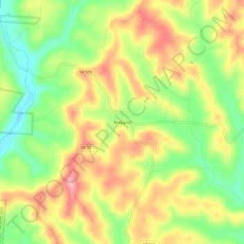
Name: Ringgold topographic map, elevation, terrain.
Location: Ringgold, Morgan County, Ohio, United States (39.57035 -81.99959 39.61035 -81.95959)
Average elevation: 287 m
Minimum elevation: 221 m
Maximum elevation: 352 m
Thank you for supporting this site ❤️
Make a donation
Make a donation
Other topographic maps
Click on a map to view its topography, its elevation and its terrain.