
Thank you for supporting this site ❤️
Make a donation
Make a donation
De Soto topographic map
Click on the map to display elevation.
Thank you for supporting this site ❤️
Make a donation
Make a donation
About this map
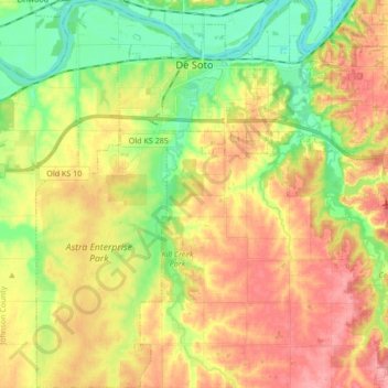
Name: De Soto topographic map, elevation, terrain.
Location: De Soto, Johnson County, Kansas, United States (38.86942 -95.03785 39.00089 -94.90869)
Average elevation: 276 m
Minimum elevation: 228 m
Maximum elevation: 325 m
Thank you for supporting this site ❤️
Make a donation
Make a donation
Other topographic maps
Click on a map to view its topography, its elevation and its terrain.