
Raison topographic map
Click on the map to display elevation.
About this map
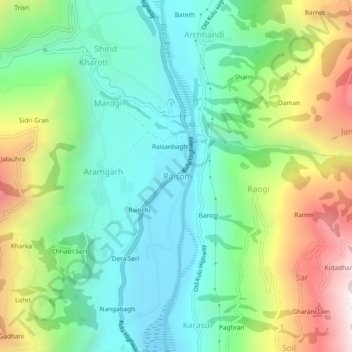
Name: Raison topographic map, elevation, terrain.
Location: Raison, Kullu, Himachal Pradesh, 175128, India (32.03782 77.11493 32.07782 77.15493)
Average elevation: 1,701 m
Minimum elevation: 1,314 m
Maximum elevation: 2,590 m
Other topographic maps
Click on a map to view its topography, its elevation and its terrain.