
Thank you for supporting this site ❤️
Make a donation
Make a donation
Moro topographic map
Click on the map to display elevation.
Thank you for supporting this site ❤️
Make a donation
Make a donation
About this map
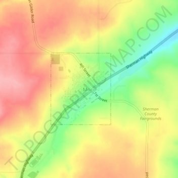
Name: Moro topographic map, elevation, terrain.
Location: Moro, Sherman County, Oregon, United States (45.47870 -120.73948 45.48957 -120.72650)
Average elevation: 587 m
Minimum elevation: 521 m
Maximum elevation: 634 m
Thank you for supporting this site ❤️
Make a donation
Make a donation
Other topographic maps
Click on a map to view its topography, its elevation and its terrain.