
亚来乡 topographic map
Interactive map
Click on the map to display elevation.
About this map
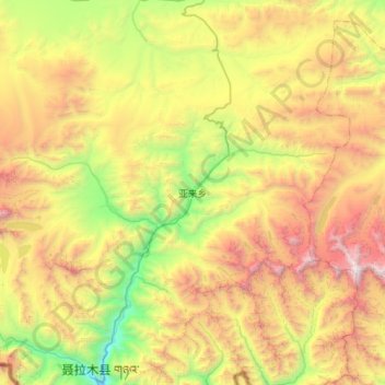
Name: 亚来乡 topographic map, elevation, terrain.
Location: 亚来乡, 聂拉木县, 日喀则市, 西藏自治区, 中国 (28.29108 85.76453 28.51407 86.32019)
Average elevation: 5,168 m
Minimum elevation: 3,801 m
Maximum elevation: 7,287 m
Other topographic maps
Click on a map to view its topography, its elevation and its terrain.