
Thank you for supporting this site ❤️
Make a donation
Make a donation
Thaxton topographic map
Click on the map to display elevation.
Thank you for supporting this site ❤️
Make a donation
Make a donation
About this map
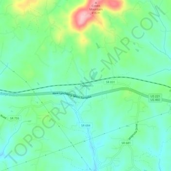
Name: Thaxton topographic map, elevation, terrain.
Location: Thaxton, Bedford County, Virginia, United States (37.33292 -79.63642 37.37292 -79.59642)
Average elevation: 304 m
Minimum elevation: 258 m
Maximum elevation: 423 m
Thank you for supporting this site ❤️
Make a donation
Make a donation
Other topographic maps
Click on a map to view its topography, its elevation and its terrain.