
Thank you for supporting this site ❤️
Make a donation
Make a donation
Outrouville topographic map
Click on the map to display elevation.
Thank you for supporting this site ❤️
Make a donation
Make a donation
About this map
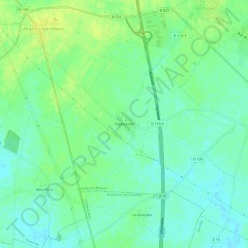
Name: Outrouville topographic map, elevation, terrain.
Average elevation: 134 m
Minimum elevation: 126 m
Maximum elevation: 144 m
Thank you for supporting this site ❤️
Make a donation
Make a donation
Other topographic maps
Click on a map to view its topography, its elevation and its terrain.
Allaines-Mervilliers
France > Centre-Val de Loire > Eure-et-Loir > Janville-en-Beauce
Average elevation: 133 m