
Lizard topographic map
Click on the map to display elevation.
About this map
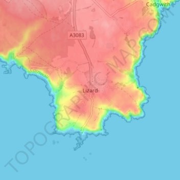
Name: Lizard topographic map, elevation, terrain.
Location: Lizard, Cornwall, England, TR12 7NH, United Kingdom (49.94877 -5.22392 49.98877 -5.18392)
Average elevation: 30 m
Minimum elevation: -1 m
Maximum elevation: 80 m
Other topographic maps
Click on a map to view its topography, its elevation and its terrain.