
Thank you for supporting this site ❤️
Make a donation
Make a donation
Maypearl topographic map
Click on the map to display elevation.
Thank you for supporting this site ❤️
Make a donation
Make a donation
About this map
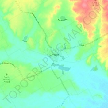
Name: Maypearl topographic map, elevation, terrain.
Location: Maypearl, Ellis County, Texas, United States (32.28051 -97.04139 32.34343 -96.94431)
Average elevation: 175 m
Minimum elevation: 151 m
Maximum elevation: 230 m
Thank you for supporting this site ❤️
Make a donation
Make a donation
Other topographic maps
Click on a map to view its topography, its elevation and its terrain.