
Thank you for supporting this site ❤️
Make a donation
Make a donation
Ovit Dağı topographic map
Click on the map to display elevation.
Thank you for supporting this site ❤️
Make a donation
Make a donation
About this map
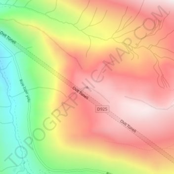
Name: Ovit Dağı topographic map, elevation, terrain.
Location: Ovit Dağı, İkizdere, Rize, Black Sea Region, Turkey (40.64092 40.75134 40.64102 40.75144)
Average elevation: 2,712 m
Minimum elevation: 2,171 m
Maximum elevation: 3,108 m
Thank you for supporting this site ❤️
Make a donation
Make a donation