
Thank you for supporting this site ❤️
Make a donation
Make a donation
Öjsberget topographic map
Click on the map to display elevation.
Thank you for supporting this site ❤️
Make a donation
Make a donation
About this map
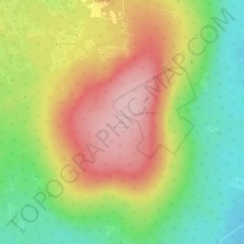
Name: Öjsberget topographic map, elevation, terrain.
Location: Öjsberget, Gemeinde Malung-Sälen, Provinz Dalarna, Schweden (60.76072 13.80594 60.76082 13.80604)
Average elevation: 405 m
Minimum elevation: 306 m
Maximum elevation: 509 m
Thank you for supporting this site ❤️
Make a donation
Make a donation
Other topographic maps
Click on a map to view its topography, its elevation and its terrain.
Thank you for supporting this site ❤️
Make a donation
Make a donation
Thank you for supporting this site ❤️
Make a donation
Make a donation
Thank you for supporting this site ❤️
Make a donation
Make a donation