
Thank you for supporting this site ❤️
Make a donation
Make a donation
Fischer topographic map
Click on the map to display elevation.
Thank you for supporting this site ❤️
Make a donation
Make a donation
About this map
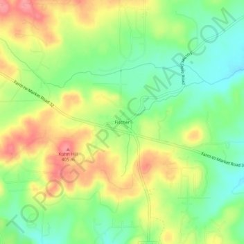
Name: Fischer topographic map, elevation, terrain.
Location: Fischer, Comal County, Texas, 78623, United States (29.95688 -98.28585 29.99688 -98.24585)
Average elevation: 363 m
Minimum elevation: 324 m
Maximum elevation: 408 m
Thank you for supporting this site ❤️
Make a donation
Make a donation
Other topographic maps
Click on a map to view its topography, its elevation and its terrain.