
Thank you for supporting this site ❤️
Make a donation
Make a donation
Kortenaken topographic map
Click on the map to display elevation.
Thank you for supporting this site ❤️
Make a donation
Make a donation
About this map
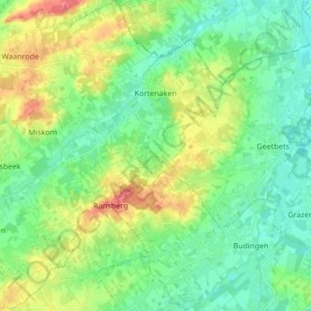
Name: Kortenaken topographic map, elevation, terrain.
Location: Kortenaken, Leuven, Flemish Brabant, Belgium (50.84556 4.96921 50.93259 5.09224)
Average elevation: 41 m
Minimum elevation: 19 m
Maximum elevation: 85 m
Thank you for supporting this site ❤️
Make a donation
Make a donation