
Thank you for supporting this site ❤️
Make a donation
Make a donation
Drift Creek topographic map
Click on the map to display elevation.
Thank you for supporting this site ❤️
Make a donation
Make a donation
About this map
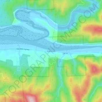
Name: Drift Creek topographic map, elevation, terrain.
Location: Drift Creek, Lincoln County, Oregon, United States (44.39250 -124.01602 44.43250 -123.97602)
Average elevation: 94 m
Minimum elevation: -8 m
Maximum elevation: 332 m
Thank you for supporting this site ❤️
Make a donation
Make a donation
Other topographic maps
Click on a map to view its topography, its elevation and its terrain.