
Thank you for supporting this site ❤️
Make a donation
Make a donation
Medway topographic map
Click on the map to display elevation.
Thank you for supporting this site ❤️
Make a donation
Make a donation
About this map
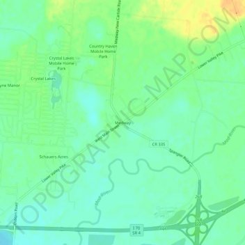
Name: Medway topographic map, elevation, terrain.
Location: Medway, Clark County, Ohio, 45341, United States (39.86200 -84.02966 39.90200 -83.98966)
Average elevation: 259 m
Minimum elevation: 248 m
Maximum elevation: 278 m
Thank you for supporting this site ❤️
Make a donation
Make a donation
Other topographic maps
Click on a map to view its topography, its elevation and its terrain.
Thank you for supporting this site ❤️
Make a donation
Make a donation
Thank you for supporting this site ❤️
Make a donation
Make a donation