
Thank you for supporting this site ❤️
Make a donation
Make a donation
Tannenbaum topographic map
Click on the map to display elevation.
Thank you for supporting this site ❤️
Make a donation
Make a donation
About this map
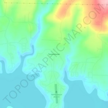
Name: Tannenbaum topographic map, elevation, terrain.
Location: Tannenbaum, Cleburne County, Arkansas, United States (35.53897 -92.07709 35.57897 -92.03709)
Average elevation: 179 m
Minimum elevation: 134 m
Maximum elevation: 308 m
Thank you for supporting this site ❤️
Make a donation
Make a donation
Other topographic maps
Click on a map to view its topography, its elevation and its terrain.