
Thank you for supporting this site ❤️
Make a donation
Make a donation
Cragford topographic map
Click on the map to display elevation.
Thank you for supporting this site ❤️
Make a donation
Make a donation
About this map
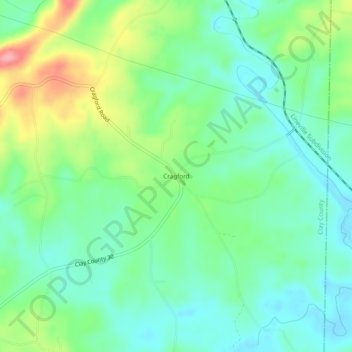
Name: Cragford topographic map, elevation, terrain.
Location: Cragford, Clay County, Alabama, United States (33.23097 -85.69239 33.27097 -85.65239)
Average elevation: 250 m
Minimum elevation: 214 m
Maximum elevation: 331 m
Thank you for supporting this site ❤️
Make a donation
Make a donation
Other topographic maps
Click on a map to view its topography, its elevation and its terrain.