
Thank you for supporting this site ❤️
Make a donation
Make a donation
Three Rivers State Park topographic map
Click on the map to display elevation.
Thank you for supporting this site ❤️
Make a donation
Make a donation
About this map
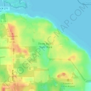
Name: Three Rivers State Park topographic map, elevation, terrain.
Average elevation: 41 m
Minimum elevation: 22 m
Maximum elevation: 69 m
Thank you for supporting this site ❤️
Make a donation
Make a donation
Other topographic maps
Click on a map to view its topography, its elevation and its terrain.
Graceville
United States > Florida > Jackson County
Jackson County is a rural community primarily composed of business in agriculture, manufacturing, service, and retail trade. In addition, many government facilities are located within the county, including a federal prison and three state correctional institutions. Elevation ranges from 50 to 330 feet (100 m)…
Average elevation: 48 m
Thank you for supporting this site ❤️
Make a donation
Make a donation
Thank you for supporting this site ❤️
Make a donation
Make a donation
Thank you for supporting this site ❤️
Make a donation
Make a donation