
Thank you for supporting this site ❤️
Make a donation
Make a donation
Kalaklan topographic map
Click on the map to display elevation.
Thank you for supporting this site ❤️
Make a donation
Make a donation
About this map
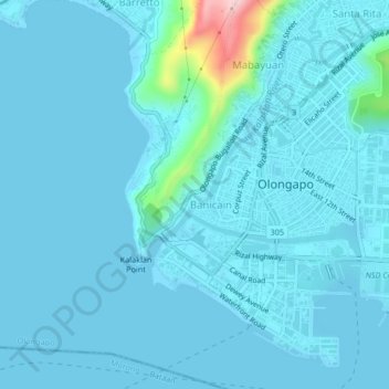
Name: Kalaklan topographic map, elevation, terrain.
Location: Kalaklan, Olongapo, Central Luzon, 2200, Philippines (14.81036 120.25380 14.85036 120.29380)
Average elevation: 18 m
Minimum elevation: -1 m
Maximum elevation: 233 m
Thank you for supporting this site ❤️
Make a donation
Make a donation
Other topographic maps
Click on a map to view its topography, its elevation and its terrain.