
Thank you for supporting this site ❤️
Make a donation
Make a donation
Katarnag Peak topographic map
Click on the map to display elevation.
Thank you for supporting this site ❤️
Make a donation
Make a donation
About this map
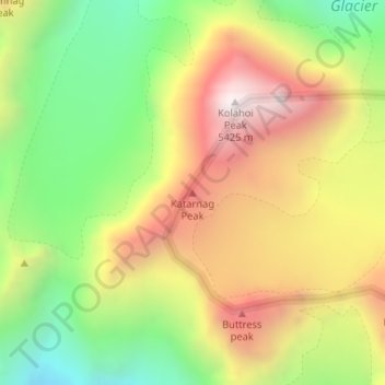
Name: Katarnag Peak topographic map, elevation, terrain.
Location: Katarnag Peak, Pahalgam, Anantnag, Jammu and Kashmir, India (34.15821 75.32324 34.15831 75.32334)
Average elevation: 4,675 m
Minimum elevation: 4,096 m
Maximum elevation: 5,297 m
Thank you for supporting this site ❤️
Make a donation
Make a donation
Other topographic maps
Click on a map to view its topography, its elevation and its terrain.