
Thank you for supporting this site ❤️
Make a donation
Make a donation
Dodurga topographic map
Click on the map to display elevation.
Thank you for supporting this site ❤️
Make a donation
Make a donation
About this map
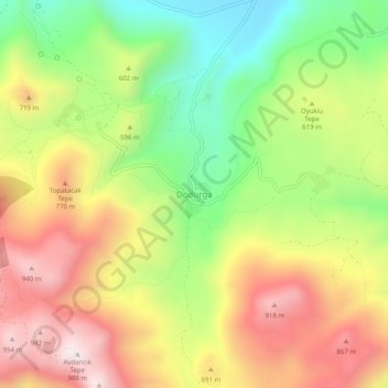
Name: Dodurga topographic map, elevation, terrain.
Location: Dodurga, Seydikemer, Muğla, Aegean Region, Turkey (36.38041 29.18529 36.42041 29.22529)
Average elevation: 602 m
Minimum elevation: 218 m
Maximum elevation: 1,001 m
Thank you for supporting this site ❤️
Make a donation
Make a donation