
Thank you for supporting this site ❤️
Make a donation
Make a donation
Wyatt topographic map
Click on the map to display elevation.
Thank you for supporting this site ❤️
Make a donation
Make a donation
About this map
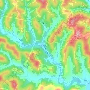
Name: Wyatt topographic map, elevation, terrain.
Location: Wyatt, Harrison County, West Virginia, United States (39.41509 -80.37342 39.45509 -80.33342)
Average elevation: 356 m
Minimum elevation: 284 m
Maximum elevation: 463 m
Thank you for supporting this site ❤️
Make a donation
Make a donation
Other topographic maps
Click on a map to view its topography, its elevation and its terrain.