
Thank you for supporting this site ❤️
Make a donation
Make a donation
Velas topographic map
Click on the map to display elevation.
Thank you for supporting this site ❤️
Make a donation
Make a donation
About this map
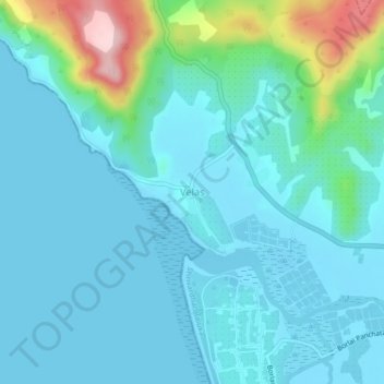
Name: Velas topographic map, elevation, terrain.
Location: Velas, Shrivardhan Taluka, Raigad, Maharashtra, 402403, India (18.18159 72.95983 18.22159 72.99983)
Average elevation: 40 m
Minimum elevation: -2 m
Maximum elevation: 248 m
Thank you for supporting this site ❤️
Make a donation
Make a donation
Other topographic maps
Click on a map to view its topography, its elevation and its terrain.