
Make a donation
Four Corners topographic map
Click on the map to display elevation.
Make a donation
About this map
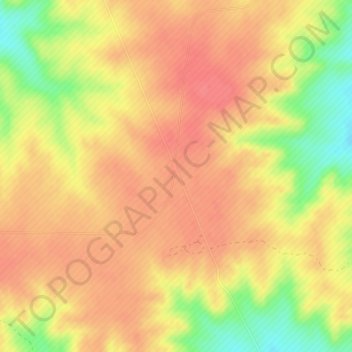
Name: Four Corners topographic map, elevation, terrain.
Location: Four Corners, Las Animas County, Colorado, United States (37.51180 -104.01369 37.53180 -103.99369)
Average elevation: 1,684 m
Minimum elevation: 1,643 m
Maximum elevation: 1,704 m
Make a donation
Other topographic maps
Click on a map to view its topography, its elevation and its terrain.
Trinidad
United States > Colorado > Las Animas County
Trinidad is situated in the Purgatoire River valley in far southern Colorado at an elevation of 6,025 ft (1,836 m). The city lies 13 mi north of the New Mexico border. On the northern end of the town is Simpson's Rest, a prominent bluff named for early resident George Simpson, who is buried atop it. North…
Average elevation: 1,907 m
Make a donation