
Jabi topographic map
Click on the map to display elevation.
About this map
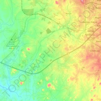
Name: Jabi topographic map, elevation, terrain.
Location: Jabi, Municipal Area Council, Federal Capital Territory, Nigeria (8.90912 7.25611 9.06104 7.45709)
Average elevation: 378 m
Minimum elevation: 273 m
Maximum elevation: 570 m
Other topographic maps
Click on a map to view its topography, its elevation and its terrain.