
Haselstein topographic map
Click on the map to display elevation.
About this map
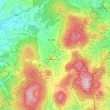
Name: Haselstein topographic map, elevation, terrain.
Location: Haselstein, Nüsttal, Landkreis Fulda, Hesse, Germany (50.65672 9.82565 50.70850 9.88259)
Average elevation: 429 m
Minimum elevation: 302 m
Maximum elevation: 576 m