
Thank you for supporting this site ❤️
Make a donation
Make a donation
Wilsons Corner topographic map
Click on the map to display elevation.
Thank you for supporting this site ❤️
Make a donation
Make a donation
About this map
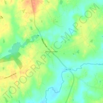
Name: Wilsons Corner topographic map, elevation, terrain.
Location: Wilsons Corner, Amelia County, Virginia, United States (37.27071 -77.89639 37.31071 -77.85639)
Average elevation: 75 m
Minimum elevation: 53 m
Maximum elevation: 106 m
Thank you for supporting this site ❤️
Make a donation
Make a donation
Other topographic maps
Click on a map to view its topography, its elevation and its terrain.