
Thank you for supporting this site ❤️
Make a donation
Make a donation
Lewis Mountain topographic map
Click on the map to display elevation.
Thank you for supporting this site ❤️
Make a donation
Make a donation
About this map
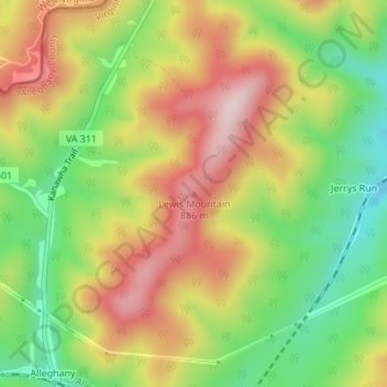
Name: Lewis Mountain topographic map, elevation, terrain.
Location: Lewis Mountain, Alleghany County, Virginia, United States (37.75979 -80.22790 37.75989 -80.22780)
Average elevation: 742 m
Minimum elevation: 573 m
Maximum elevation: 919 m
Thank you for supporting this site ❤️
Make a donation
Make a donation
Other topographic maps
Click on a map to view its topography, its elevation and its terrain.