
Thank you for supporting this site ❤️
Make a donation
Make a donation
Glen Sandfield topographic map
Click on the map to display elevation.
Thank you for supporting this site ❤️
Make a donation
Make a donation
About this map
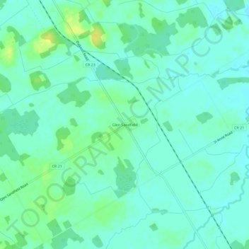
Name: Glen Sandfield topographic map, elevation, terrain.
Average elevation: 74 m
Minimum elevation: 67 m
Maximum elevation: 87 m
Thank you for supporting this site ❤️
Make a donation
Make a donation
Other topographic maps
Click on a map to view its topography, its elevation and its terrain.
Middle Lake
Canada > Ontario > Stormont, Dundas and Glengarry Counties > North Glengarry > Alexandria
Average elevation: 90 m