
Thank you for supporting this site ❤️
Make a donation
Make a donation
Arkansas topographic map
Click on the map to display elevation.
Thank you for supporting this site ❤️
Make a donation
Make a donation
About this map
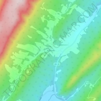
Name: Arkansas topographic map, elevation, terrain.
Location: Arkansas, Hardy County, West Virginia, United States (39.05455 -78.74918 39.09455 -78.70918)
Average elevation: 540 m
Minimum elevation: 383 m
Maximum elevation: 871 m
Thank you for supporting this site ❤️
Make a donation
Make a donation
Other topographic maps
Click on a map to view its topography, its elevation and its terrain.