
Thank you for supporting this site ❤️
Make a donation
Make a donation
Hilders topographic map
Click on the map to display elevation.
Thank you for supporting this site ❤️
Make a donation
Make a donation
Hilders
Die Gemeinde liegt im Naturpark Hessische Rhön nordöstlich der Wasserkuppe auf 460 bis 800 Meter Höhe im Ulstertal, 30 km östlich von Fulda. Im Osten grenzt die Gemeinde an Thüringen.
Thank you for supporting this site ❤️
Make a donation
Make a donation
About this map
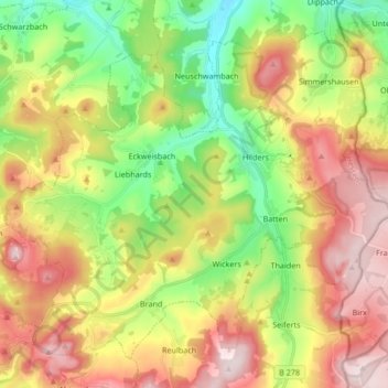
Name: Hilders topographic map, elevation, terrain.
Location: Hilders, Landkreis Fulda, Hessen, 36115, Deutschland (50.51667 9.89394 50.60707 10.06171)
Average elevation: 577 m
Minimum elevation: 381 m
Maximum elevation: 809 m
Thank you for supporting this site ❤️
Make a donation
Make a donation
Other topographic maps
Click on a map to view its topography, its elevation and its terrain.