
Thank you for supporting this site ❤️
Make a donation
Make a donation
Osteen topographic map
Click on the map to display elevation.
Thank you for supporting this site ❤️
Make a donation
Make a donation
About this map
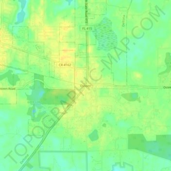
Name: Osteen topographic map, elevation, terrain.
Location: Osteen, Volusia County, Florida, 32764, United States (28.82610 -81.18256 28.86610 -81.14256)
Average elevation: 12 m
Minimum elevation: 0 m
Maximum elevation: 22 m
Thank you for supporting this site ❤️
Make a donation
Make a donation
Other topographic maps
Click on a map to view its topography, its elevation and its terrain.
Thank you for supporting this site ❤️
Make a donation
Make a donation
Thank you for supporting this site ❤️
Make a donation
Make a donation