
Thank you for supporting this site ❤️
Make a donation
Make a donation
Cotton topographic map
Click on the map to display elevation.
Thank you for supporting this site ❤️
Make a donation
Make a donation
About this map
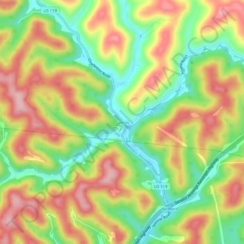
Name: Cotton topographic map, elevation, terrain.
Location: Cotton, Roane County, West Virginia, United States (38.52482 -81.36984 38.56482 -81.32984)
Average elevation: 276 m
Minimum elevation: 184 m
Maximum elevation: 368 m
Thank you for supporting this site ❤️
Make a donation
Make a donation
Other topographic maps
Click on a map to view its topography, its elevation and its terrain.