
Para topographic map
Click on the map to display elevation.
About this map
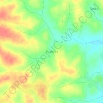
Name: Para topographic map, elevation, terrain.
Location: Para, Lagelu, Oyo State, Nigeria (7.48000 4.03000 7.52000 4.07000)
Average elevation: 218 m
Minimum elevation: 186 m
Maximum elevation: 252 m