
德清县 topographic map
Interactive map
Click on the map to display elevation.
About this map
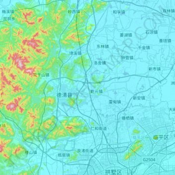
Name: 德清县 topographic map, elevation, terrain.
Location: 德清县, 湖州市, 浙江省, 中国 (30.42773 119.75658 30.69761 120.33950)
Average elevation: 61 m
Minimum elevation: -3 m
Maximum elevation: 705 m
Other topographic maps
Click on a map to view its topography, its elevation and its terrain.