
Thank you for supporting this site ❤️
Make a donation
Make a donation
Lac De Tunis topographic map
Click on the map to display elevation.
Thank you for supporting this site ❤️
Make a donation
Make a donation
About this map
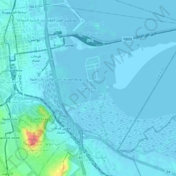
Name: Lac De Tunis topographic map, elevation, terrain.
Location: Lac De Tunis, Bab Bhar, Tunis, 1151, Tunisie (36.77853 10.18131 36.80289 10.22394)
Average elevation: 6 m
Minimum elevation: -8 m
Maximum elevation: 83 m
Thank you for supporting this site ❤️
Make a donation
Make a donation
Other topographic maps
Click on a map to view its topography, its elevation and its terrain.