
Thank you for supporting this site ❤️
Make a donation
Make a donation
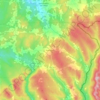
Saint-Malo topographic map
Click on the map to display elevation.
Thank you for supporting this site ❤️
Make a donation
Make a donation
Saint-Malo
Saint-Malo (local pronunciation) is a municipality in Quebec, Canada, on the Canada–United States border. Saint-Malo has the highest elevation of any municipality in Quebec. At 640 metres (2,100 ft), local residents live in an environment of forests, farms, and waterways that supply their livelihood.
Thank you for supporting this site ❤️
Make a donation
Make a donation
About this map
Name: Saint-Malo topographic map, elevation, terrain.
Location: Saint-Malo, Coaticook (MRC), Estrie, Quebec, Canada (45.15942 -71.60477 45.24086 -71.39735)
Average elevation: 484 m
Minimum elevation: 323 m
Maximum elevation: 707 m
Thank you for supporting this site ❤️
Make a donation
Make a donation