
Sierra Nevada topographic map
Interactive map
Click on the map to display elevation.
About this map
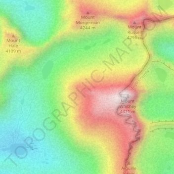
Name: Sierra Nevada topographic map, elevation, terrain.
Location: Sierra Nevada, Tulare County, California, United States (36.57995 -118.30005 36.58005 -118.29995)
Average elevation: 3,888 m
Minimum elevation: 3,492 m
Maximum elevation: 4,415 m
Other topographic maps
Click on a map to view its topography, its elevation and its terrain.
Allensworth
United States > California > Tulare County
Allensworth, Tulare County, California, United States
Average elevation: 63 m