
Thank you for supporting this site ❤️
Make a donation
Make a donation
Dorchester topographic map
Click on the map to display elevation.
Thank you for supporting this site ❤️
Make a donation
Make a donation
About this map
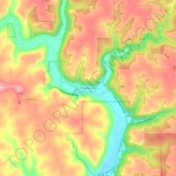
Name: Dorchester topographic map, elevation, terrain.
Location: Dorchester, Allamakee County, Iowa, 52140, United States (43.45070 -91.52909 43.49070 -91.48909)
Average elevation: 300 m
Minimum elevation: 214 m
Maximum elevation: 359 m
Thank you for supporting this site ❤️
Make a donation
Make a donation
Other topographic maps
Click on a map to view its topography, its elevation and its terrain.