
Kabardino-Balkaria topographic map
Interactive map
Click on the map to display elevation.
About this map
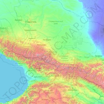
Name: Kabardino-Balkaria topographic map, elevation, terrain.
Location: Kabardino-Balkaria, North Caucasus federal district, Russia (40.88283 40.86048 46.00283 45.98048)
Average elevation: 704 m
Minimum elevation: -29 m
Maximum elevation: 5,329 m
Other topographic maps
Click on a map to view its topography, its elevation and its terrain.